Cape Blanco
Cape Blanco is a great place to stay but you have to like the wind. Even though the morning was sunny for us, there was a constant breeze that kept the temperature cool. When I spoke with one of the volunteers at the park, he said that the winds at the Cape Blanco Lighthouse can reach 125 mph in the wintertime. And today they expected gusts as high as 50-60 mph. What a wonderful day to be back on the beach!
Wind warnings notwithstanding, we were ready to get moving. So after breakfast, we loaded up our packs and made our way out of the campground.

The forest trail quickly dumped us onto a beach access road leading south.

Here, we rounded a corner and caught our first look at the clear blue sky and the seemingly calm ocean. What wind? Looks calm to me!

Further along, the road narrowed as it led us down a steep decline to the beach.

With such clear skies, we could easily see Port Orford ahead and Humbug Mountain (our destination that evening) looming in the distance. Plenty of walking today but seeing our goal made it seem a lot closer.

But first, we had to make it across Elk River.
Elk River
As we were leaving the campground, we ran into another PCT fugitive who had been forced on to OCT by snow in the Sierras. He had spent the night on the beach about 4 miles south and had successfully crossed the Elk River earlier that morning. Supposedly, the water was only thigh-deep for him, which we took as good news since he was a relatively short man (compared to me).
The river was less than 2 miles down the beach, so we knew we’d get to test our theory soon.

SIDE NOTE — According to descriptions we read, the Elk River is easy to cross at low tide. Of course, that’s helpful information if you also take the time to figure when low tide occurs on a given day at a given location. I’ll let you guess whether we did that or not.
When we arrived at the mouth of the Elk River, we were at the peak of HIGH tide.

That said, we thought we could still cross. We found what looked like the narrowest section to make an attempt.

Following our normal routine, we took a vote to see who would try to cross and I lost 4-1. Again.
Here, you can see how far I got. What you can’t see is how much deeper my next step would have been. Or what the current was like. I might have made it across (while getting very wet) but everyone else on the team would have needed to swim to follow me.
So I turned around…

This was a disappointing moment, especially since the damage was completely self-inflicted. As a next step, we either had to wait a few hours until the next low tide or track back the way we came. Keep in mind that this was the second time this had happened to us this week (see Day 15). Grrrr….
In the end, Jill wanted to wait it out but the rest of the group voted to head back to camp and regroup. So we shouldered our packs and turned to face the wind.
Yes… the wind. In case you forgot the foreshadowing I did earlier, here’s a little video that Jill took of our walk back up the beach. By this point, the winds were a steady 35 mph with gusts up to 42 mph.
Cape Blanco to Port Orford
Once we were back at the campground and had spit out all the sand we swallowed, no one really wanted to jump on the highway to walk down to Port Orford. So we phoned a friend…Cavalry Jim to the rescue!

Jim drove us down to Port Orford where we grabbed lunch at TJ’s Cafe. Port Orford has several great food options, including the Crazy Norwegian for fish and chips (next time).
From TJ’s, we walked to the end of town and back onto the beach.

Battle Rock
At the south end of Port Orford lies Battle Rock Park. It was named in honor of a conflict back in the 1850’s between the local Qua-to-mah Indian tribe and a small group European settlers who had retreated to the rock to defend themselves.

We didn’t have time to climb across the narrow walkway to the rock but we found plenty of amazing sights further down the beach.

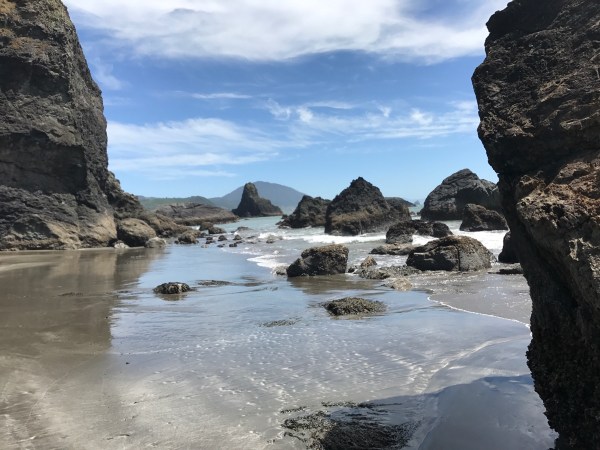
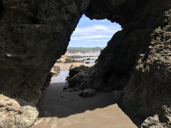
Rocks and caves and arches…. oh my!

This could be an interesting place as the tide rolls in…

From Battle Rock, we continued another 2+ miles down the beach. The tide was low so we didn’t have any of the issues we experienced earlier in the day and walked straight to Rocky Point.
Rocky Point
The approach to Rocky Point is easy to find as the landscape immediately changes from flat sand to a rock field.

At this point, we knew we’d be scrambling, so Rhonda and Jill were happy. What we didn’t realize is how much scrambling we’d end up doing before we’d see sand again at the south end of all this.

Per usual, Rhonda took the lead.

The rocks started out small but grew larger and larger…

In some cases, we could see this trek could be a lot more dangerous if the tide started coming in.

As we navigated around each corner, we expected each time to drop back down to the sand, only to find that someone moved the goalposts further down.

Along the way, we could look up and see the path that cars on the 101 would take.

Then it would be back to climbing from rock to rock.

This is one of my favorite photos from Jill showing the extent of the ascents and descents we were doing.

Eventually… finally… the hard rocks turned to soft sand again and we stumbled into a narrow path that led up the hillside.

We were covered by a green canopy again as we hiked back up to the highway.

And we’re out! With Rocky Point in the rear view, it was time to get to Humbug Mountain.

Humbug Mountain
Fortunately, we had less than a quarter-mile to walk on the 101…

Before we found a sign to Humbug Mountain and turned east.

It had been a while since we’d seen a proper OCT badge, so it was encouraging to see one marking our route up the Old Coast Highway (i.e., an old version of the 101).

I definitely liked this version of the 101 better, especially the lack of cars.

We had plenty of climbing to do on the 2-3 miles to the state park.

The views were spectacular, alternating from coastal landscape….

… to quiet, sheltered paths.

When we arrived at the state park, we found a super-nice location with tons of room to set up our tents. So much room, in fact, that we ended up inviting a group of bikers who were on their own coast journey to share our spot.

As Jill called it, we had our own little “Hiker Biker Party” that night. We made our respective dinners on the big table, built a fire, borrowed some marshmallows from the campers next door and had a great time.
All in all, even with the disappointing start to our day, things turned out pretty well in the end.

Day 18 mileage was 11.3 with 699 feet of elevation. Total distance to this point — 275.8 miles.